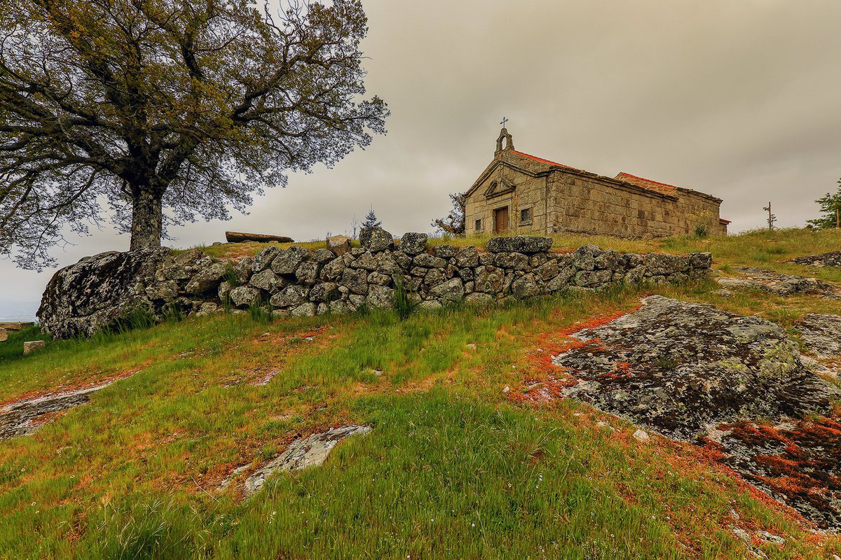
Circular path of high physical difficulty that crosses the hillside of Serra da Estrela. Along the road you will be presented with a wide panoramic view over the Middle Mondego Valley, and cross emblematic places of Seia such as the river beach of Lapa dos Dinheiros and the place of Senhora do Desterro.
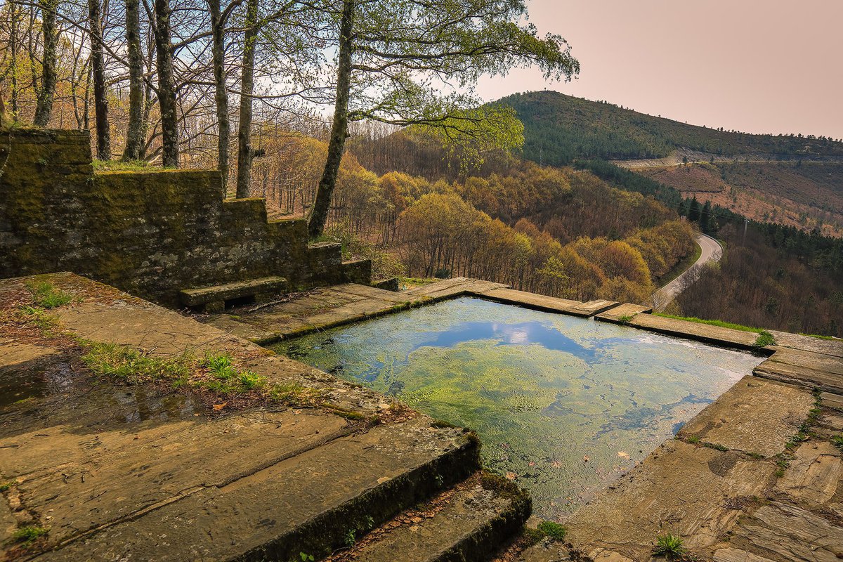
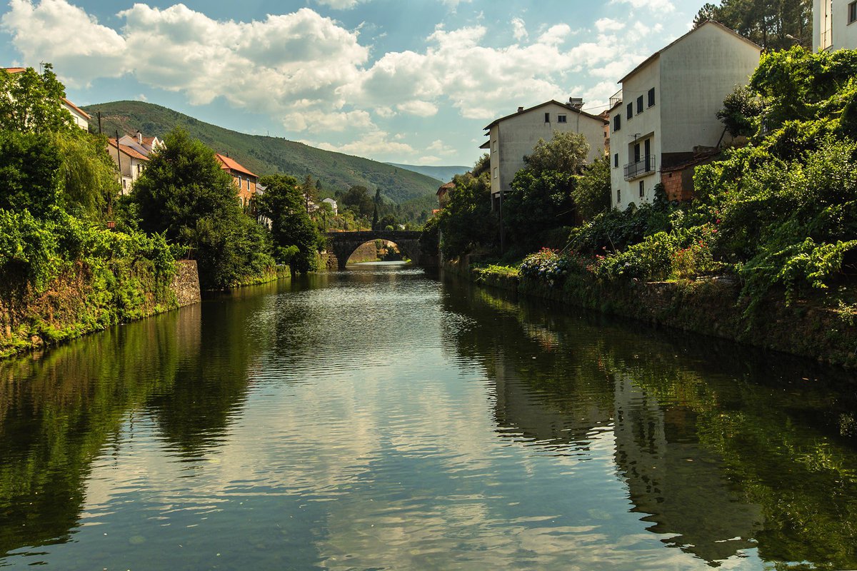
Circular route, which follows the banks of the Seia River, passing through several archaeological remains that date back to the Middle Ages, such as well-preserved bridges and pavements. This route offers several support infrastructures along the way, such as water springs and fountains, as well as cafes and restaurants.
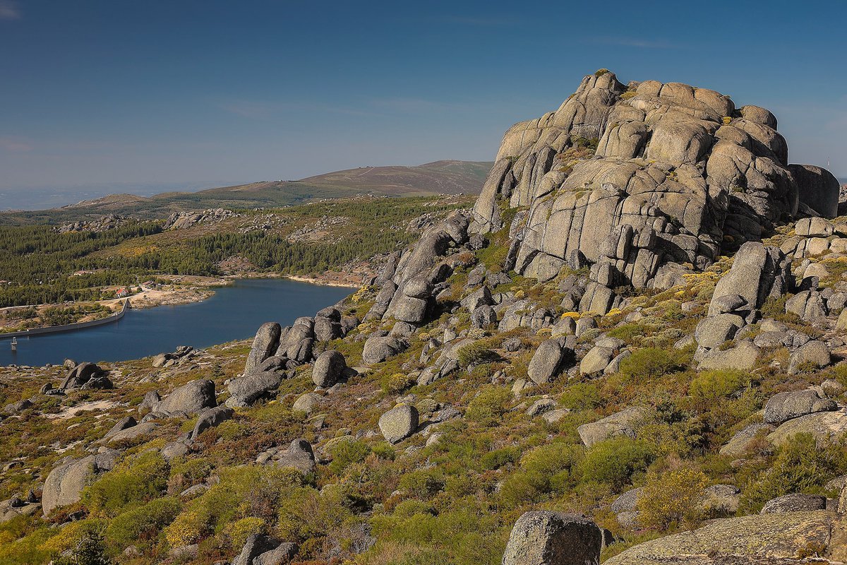
Circular route that includes the passage through several mountain areas, close to 1500 metres of altitude, of which the Rossim Valley and the locality of Penhas Douradas stand out. The circuit has a very high degree of difficulty, but provides a great quality of trails and challenges. From Penhas Douradas, it connects to route 15 of the MTB Centre of Manteigas, extending the route, which can be covered in two days. In Sabugueiro and Vale do Rossim you will find good support infrastructures.
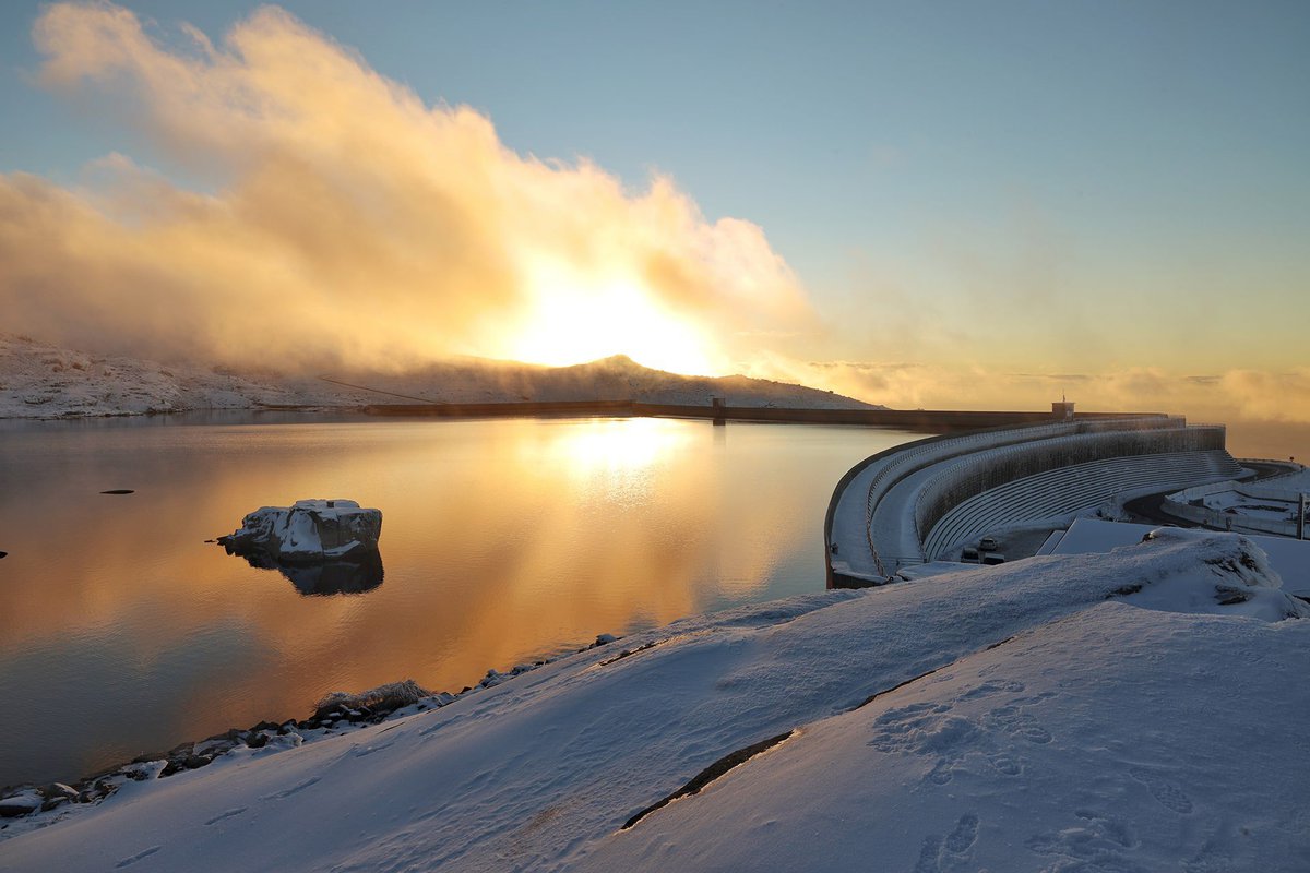
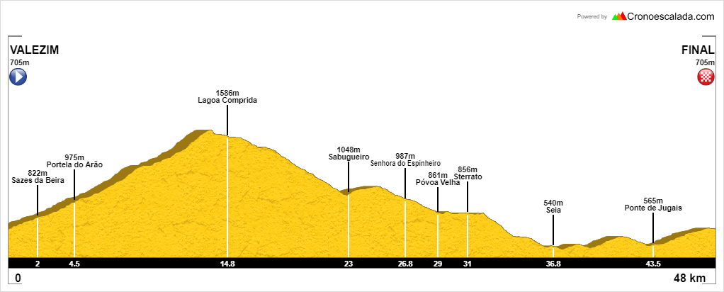
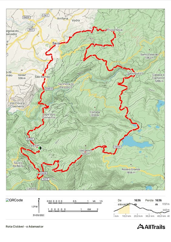
A circular route of high physical difficulty, its starting point is the mountain village of Valezim. It passes through mountainous areas with altitudes close to 1652 metres and a total distance of 48 km. The circuit is of great quality due to the type of trails and challenges provided, with the following places standing out: the ascent of São Bento (Adamastor), Lagoa Comprida, Portela do Arão, Senhora do Espinheiro, Sterrato da Póvoa Velha, Ponte dos Jugais and the city centre of Seia.
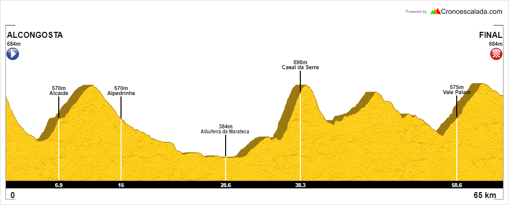
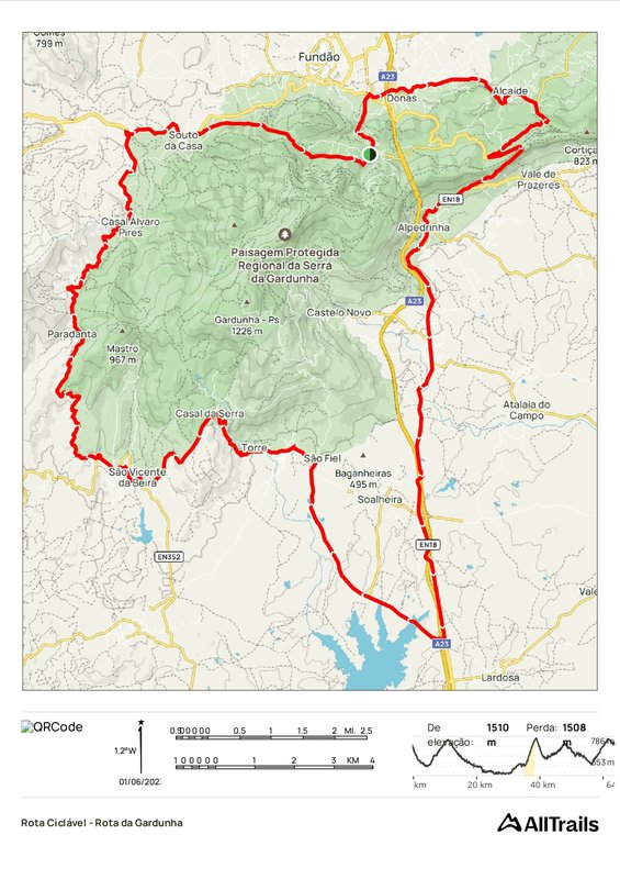
A circular route of moderate physical difficulty with a total distance of 65 kilometres. The circuit takes in the regional protected landscape of the Serra da Gardunha, passing through the mountain villages of the municipality of Fundão, Alpedrinha, Alcongosta and Alcaide. Along the way, there are many places that stand out, such as the cherry blossom fields in spring, the Albufeira da Marateca and the Casa da Cereja.
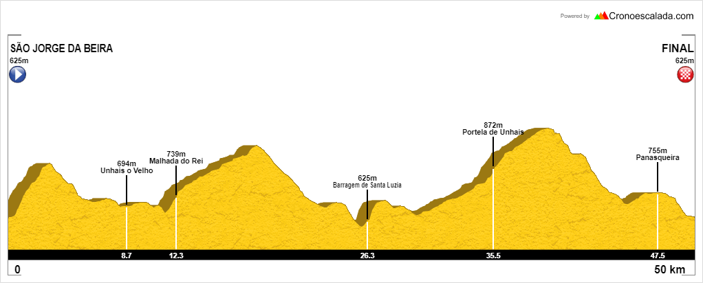
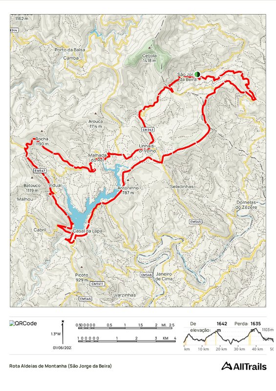
A circular route of moderate physical difficulty with a total distance of 51 kilometres. The starting point of this route is the mountain village of São Jorge da Beira, a land of mines, shepherds, farmers and charcoal burners, as well as passing through the emblematic sites of the Santa Luzia Dam, the Panasqueira Mines and the Portela de Unhais.
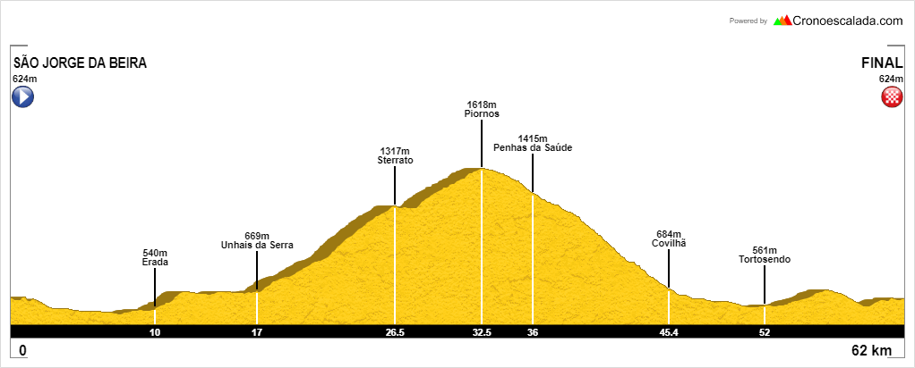
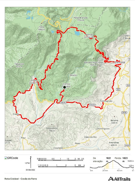
A circular route of high physical difficulty, its starting point is the "capital of natural pools", the mountain village of Cortes do Meio, in the municipality of Covilhã. This circuit, which has a total distance of 62km, is a real challenge, passing through one of the most distinctive forms of glacial erosion in the Serra da Estrela, such as Covão do Ferro, as well as other emblematic sites such as Unhais da Serra, the Penhas da Saúde mountain resort, Sterrato de Unhais, and the Carqueijais and Piornos viewpoints.
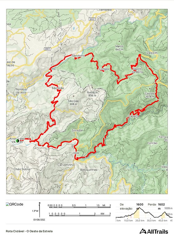
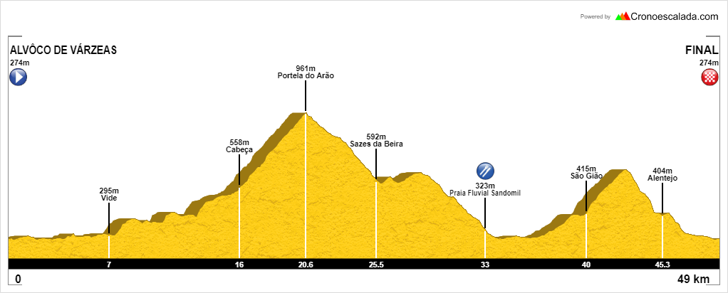
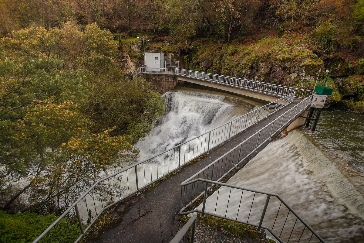
This cycling route is a circular route and is one of the shortest routes, around 50 kilometres, but it is physically very difficult as it runs along the slopes of the Serra da Estrela mountain range, providing a wide panoramic view of this mountain range. It passes through emblematic places in the municipality of Seia, such as the mountain village of Cabeça, the village of Casal de Rei, Portela do Arão and the river beach of Sandomil. In the municipality of Oliveira do Hospital, in the mountain village of Alvoco das Várzeas, the highlights are the river beach and the weirs, which during the winter are hard to choose the most beautiful.
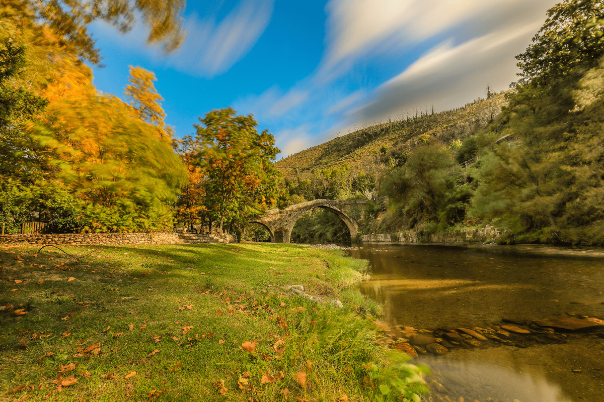
A circular route of high physical difficulty, with a total distance of 87km. The circuit starts in the town of Loriga, which is part of the network of Mountain Villages, a place that offers a wide panorama of the Loriga river beach and the Garganta de Loriga route (PR5 SEI). Along this challenging route, you'll follow the banks of the River Alva, where the river beaches of Sandomil and São Sebastião da Feira stand out. Still in the municipality of Oliveira do Hospital, when you pass the river beach of Alvoco das Várzeas, it's essential to cross the medieval bridge. In addition to these places, the Viveiros da Portela do Arão, the Pedras Lavradas and the Aldeia de Montanha da Vide also stand out.

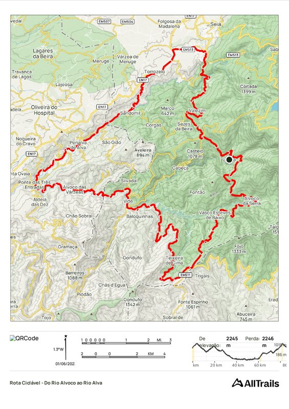
see map
 Go Back
Follow our latest news and events.